
A closer look at Storvallflon.
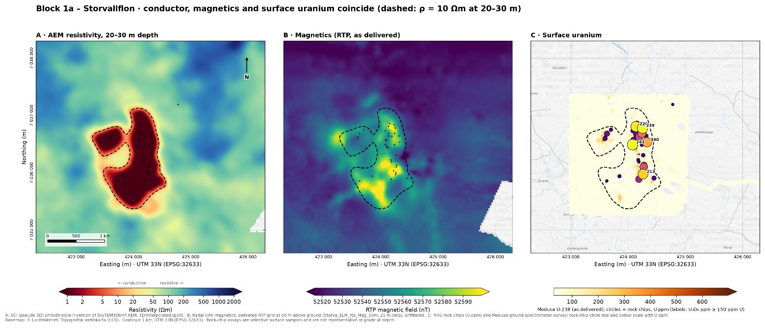
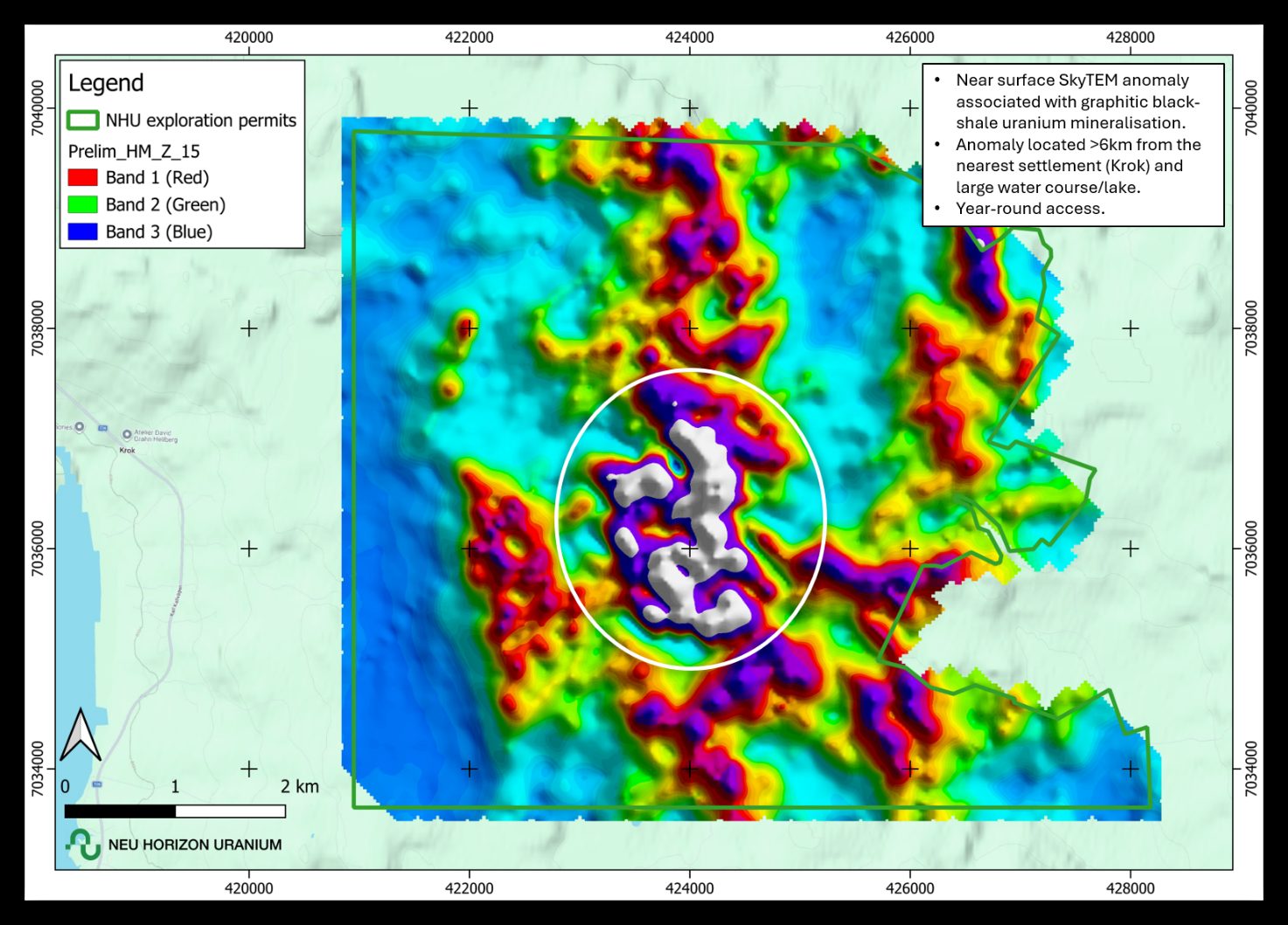
A more than 2 km-long electromagnetic conductor coincides with strongly anomalous surface uranium responses and multiple complementary geophysical and geochemical anomalies. A 4,000 m diamond drilling program is planned for Q1 2027, subject to regulatory work-plan approval.
Source: Company announcement, 14 October 2026.
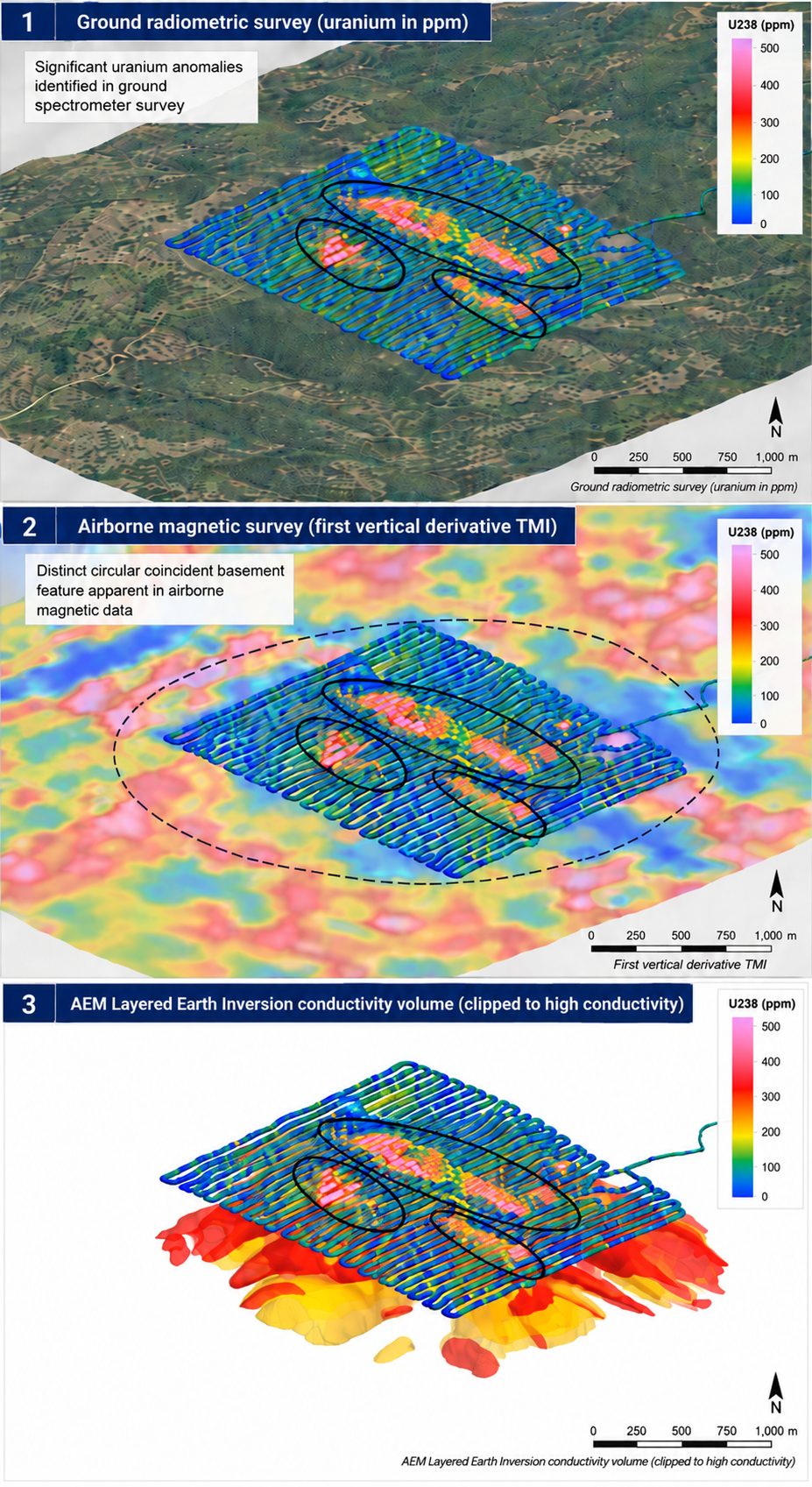
Five datasets converge on one target.
Airborne EM, drone magnetics, ground radiometrics, radon and rock-chip geochemistry identify coincident anomalies associated with uranium-bearing black shales. Ground spectrometer responses are markedly higher than at other shale-hosted prospects surveyed in the Company's 2026 field campaign.
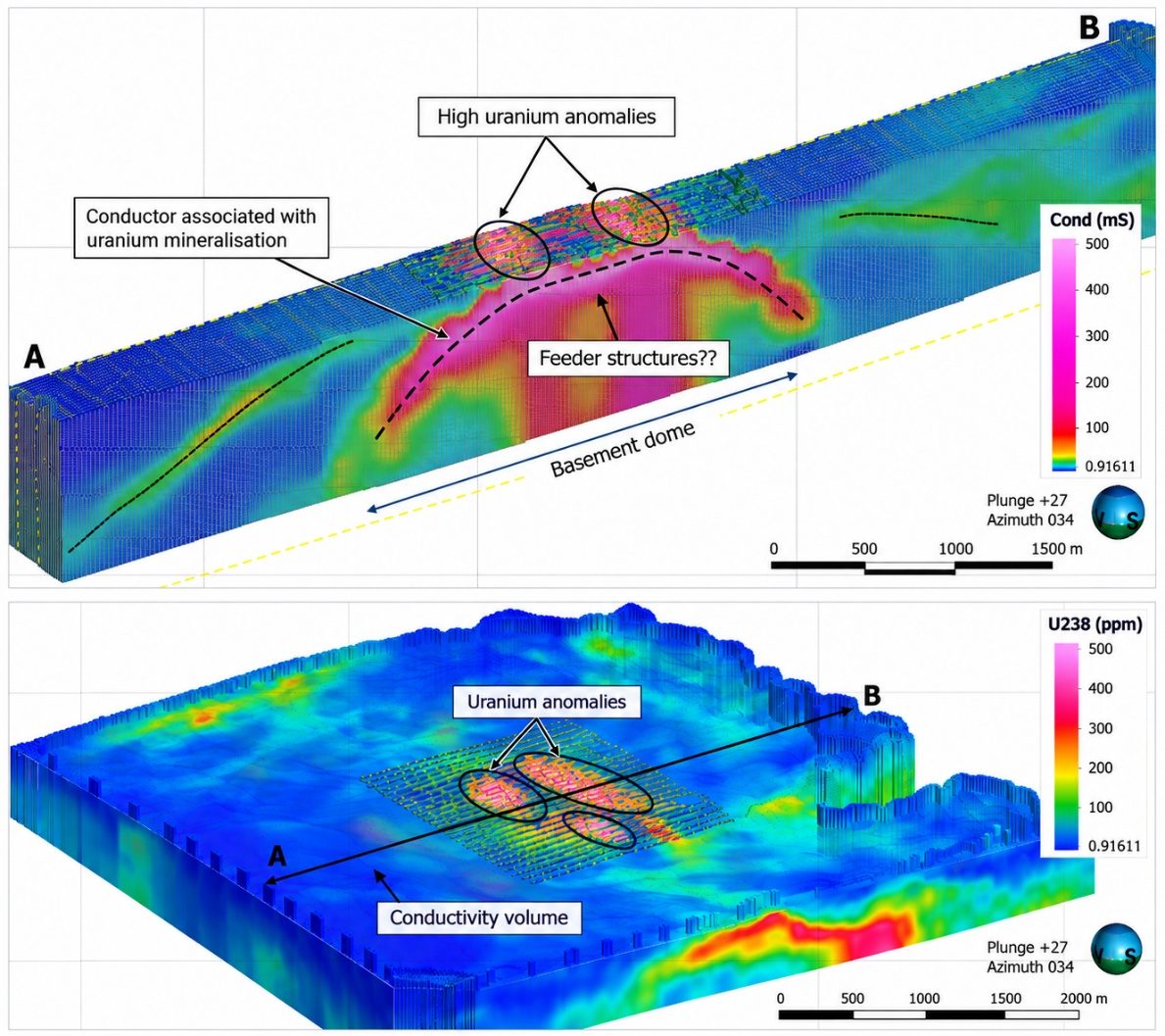
A potentially larger subsurface target.
3D inversion of the airborne EM data suggests the conductive units may form an antiformal structure, with only the crest exposed at surface and units continuing down-dip beneath the surface uranium anomalies. This interpretation does not confirm dimensions, tonnage or grade. Drilling will test it.
The Krokom black-shale project.
Four prospects make up the Krokom Black Shale Uranium Project: Storvallflon, Djupsjöberget, Kälen and Hamborg. The area is underlain by Cambrian metasediments, including uranium-bearing black shales. The Company selected it to investigate potential for structurally controlled stockwork black-shale uranium mineralisation, using Germany's Ronneburg district as a geological analogue.
Geological analogue: Ronneburg, Germany (third-party)
Ronneburg is estimated to have produced over 290 Mlbs U3O8 at average grades exceeding 900 ppm U3O8 (Gatzweiler et al., 2000). The deposits and districts referred to are outside the Company's tenements and are described for geological context only. Their presence is not necessarily indicative of mineralisation on the Company's projects. There is no certainty that further exploration will result in the discovery of an economic deposit or the definition of a Mineral Resource.
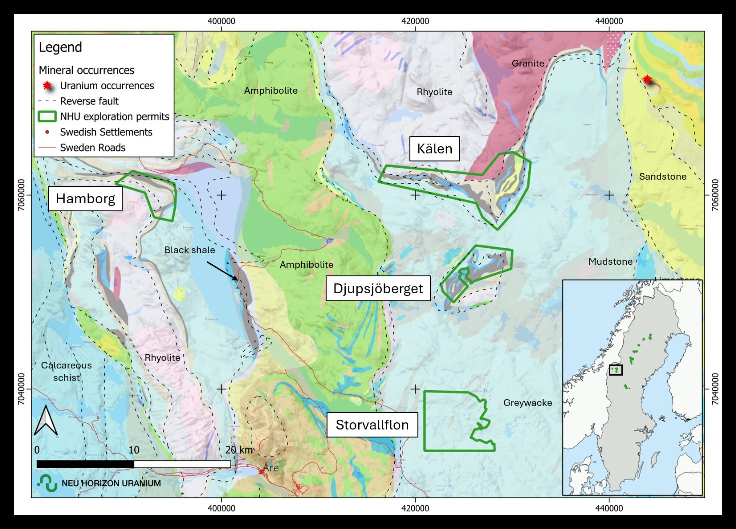
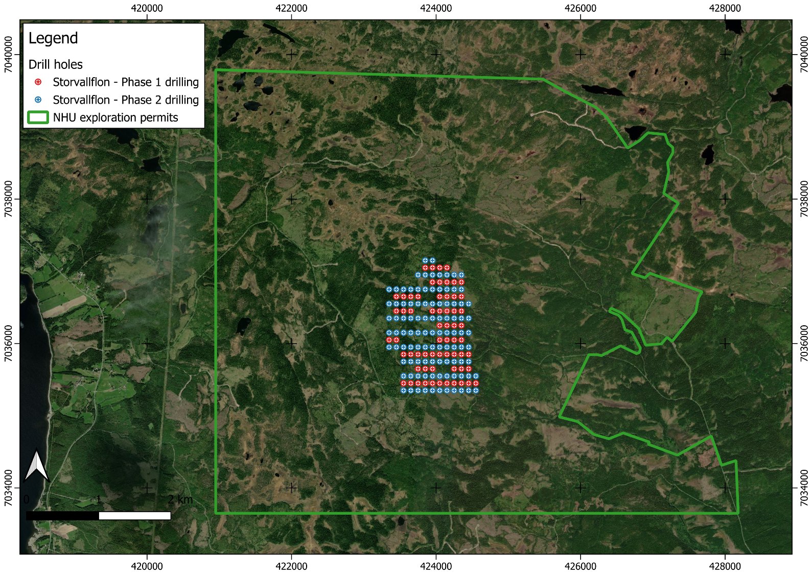
Planned drill collars.
A 4,000 m diamond drilling program is planned to test the north-south extent and depth continuity of the EM conductor along drill fences at approximately 200 m spacing, with idealised collars at 100 m intervals. Final collar locations remain subject to further interpretation of the EM inversion model, permitting and work-plan approval. Currently targeted for Q1 2027; timing is not guaranteed. No drilling has been completed.
Sources: Company announcement, 14 October 2026; Siegfried, P.R. (2026), Independent Technical Report; Gatzweiler et al. (2000).